Kolding Municipality had parking data. What it did not have was a way to see all of it at once. Coil sensors in one area. Cameras in another. Park guiding screens at key locations. Each system doing its job, but none of them connected, and no single place where a city planner ould get a complete picture of how parking across Kolding was actually being used.
new sensors installed
spaces intergrated
parking areas covered
The Challenge
Kolding Municipality had invested in parking infrastructure across the city over the years. The result was a range of detection technologies working in parallel but not together. To understand utilisation across the city, planners had to consult multiple systems and piece together a partial picture. Trends were difficult to identify, underused areas were hard to spot, and investment decisions were based more on assumption than evidence.
For residents and visitors, the fragmentation had a different cost. Without a unified data source, there was no reliable way to find available parking across the city. A public-facing tool was impossible to build on a foundation that did not exist.
The Solution
Sensade delivered a unified parking data platform for Kolding. Not by replacing what was already there, but by connecting it.
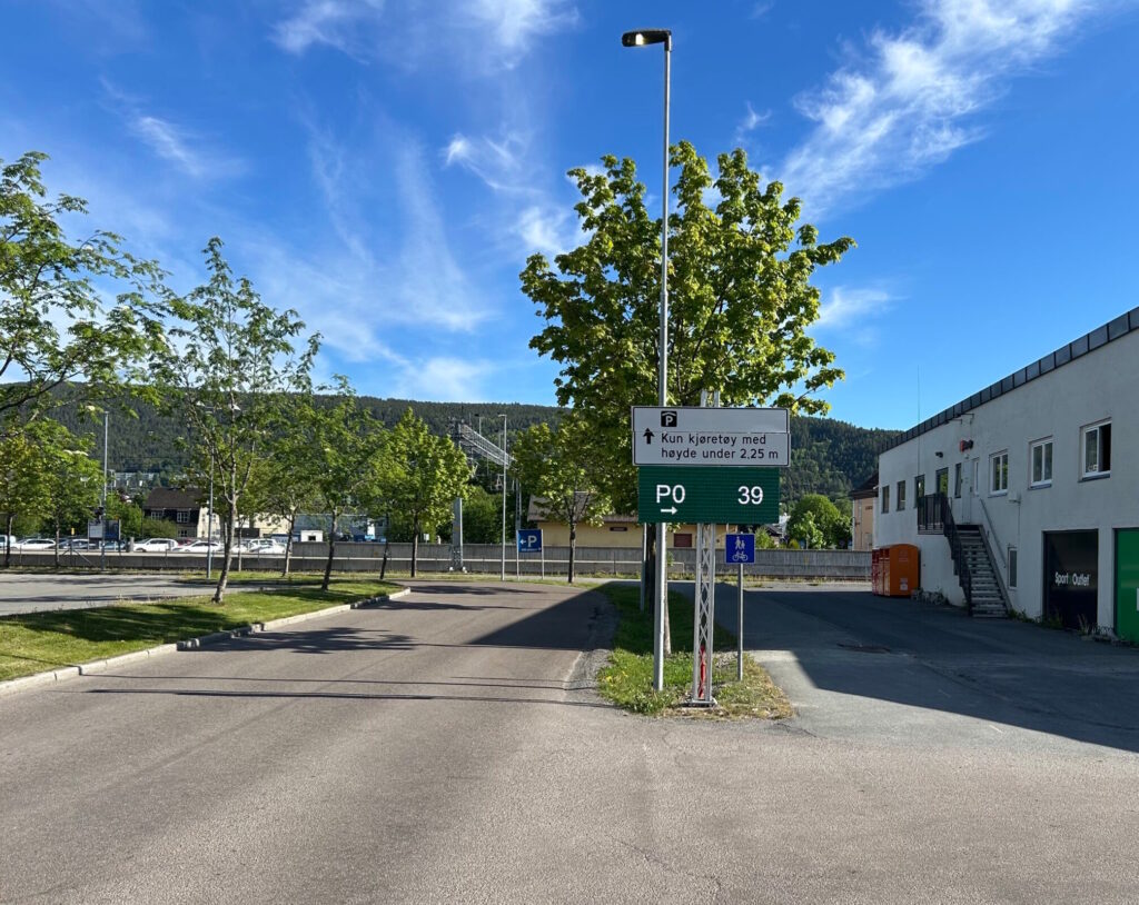
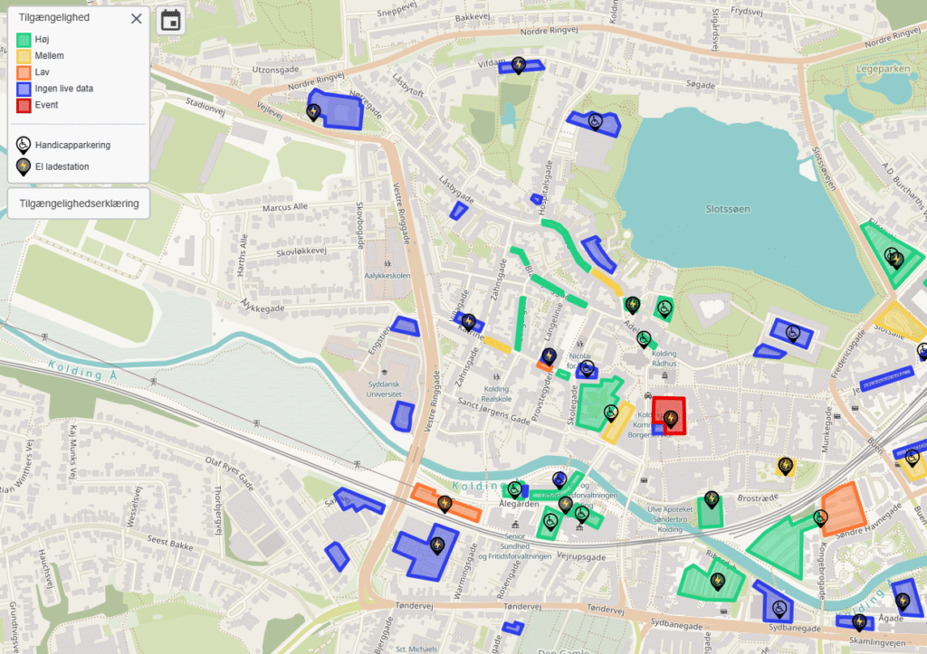
68 new wireless sensors were deployed across five streets with time-restricted parking, generating real-time occupancy data where no detection existed before. At the same time, Sensade integrated the city’s existing coil sensors and camera systems into a single, standardised data layer. The result: 2,360 parking spaces across 32 areas, all visible in one place.
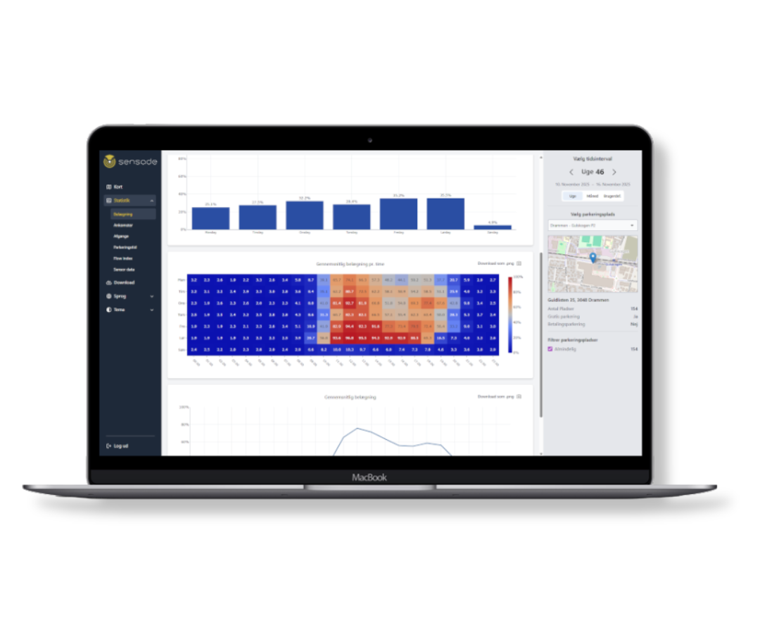
At the heart of the solution is the Sensade dashboard, giving city planners a complete, real-time overview of parking behaviour across every zone and technology in Kolding. Occupancy patterns, peak demand periods, underused areas, and high-pressure zones are all visible in one interface, turning fragmented data into a coherent planning tool.
Alongside the dashboard, Sensade developed Kolding Parkering, an app that puts real-time parking availability directly in the hands of residents and visitors. An interactive map, live occupancy data, and information on pricing, time restrictions, and zones make finding parking in Kolding straightforward, whether you know the city well or are arriving for the first time.
The same information is accessible via a dedicated web platform at parkering.kolding.dk.
The Impact
For residents and visitors, finding parking in Kolding is no longer a matter of circling and hoping. Real-time availability across the city is available at a glance, reducing search time and making the city more accessible for everyone.
For Kolding Kommune, the unified dashboard delivers something that was previously out of reach: a complete and accurate understanding of how parking infrastructure is being used across the entire city. Planners can now compare utilisation across zones, identify where demand consistently exceeds supply, and make investment decisions backed by data rather than estimates.
Kolding is one of the first municipalities in Denmark to achieve this level of digital overview across its entire parking network. The city has not just improved how it manages parking today. It has built the foundation for smarter urban planning decisions for years to come.
From Fragmented to Full Picture
Kolding’s challenge was not a lack of infrastructure or investment. It was a lack of connection. By bringing every data source together into a single platform, Sensade gave the city the visibility it needed to manage what it already had, and the intelligence to decide what comes next. The solution is built to grow. As Kolding’s parking infrastructure evolves, new locations and technologies can be added to the platform without starting from scratch.
The Results
- Full real-time visibility across all parking systems
- Unified dashboard for city planners
- Public app for residents and visitors
- Data-driven foundation for urban planning and investment decisions